

It's easy to search for existing locations/points of interest via Placer's Explore map, and to request new locations/POIs via your "My Zone" section.
Watch the video above to learn all of the details, or skim the highlights below for an overview.
Step 1: Search for a specific location
a. After logging in, you will be brought to the Explore view, which is an interactive map of the United States.
.jpg)
b. To navigate to a specific location you have three options:
i. Drag the map and zoom into the location.
ii. Use the upper search bar if you know the specific POI name (red box) or have recently accessed it.
iii. Use the lower search bar if you have the POI address, a specific name, or want to search via categories (green box).
.jpg)
c. Once you find the location you’re looking for, you’ll be able to open a Property report by clicking on Open Report and then Property.
.jpg)
Step 2: Request that specific locations be added to the platform
a. If you can’t find a location in Placer.ai, you can request it through My Zone.
Click My Zone → My Requests → Support Requests. You’ll see your existing requests (only requests submitted under your username).

b. Click Request Locations and choose from these options:
Property – Most single-location requests fall under this category.
Traffic Pin – Used to measure vehicle traffic on major roadways.
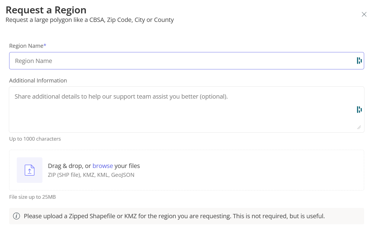
Region – Request an entire county or geographic area.
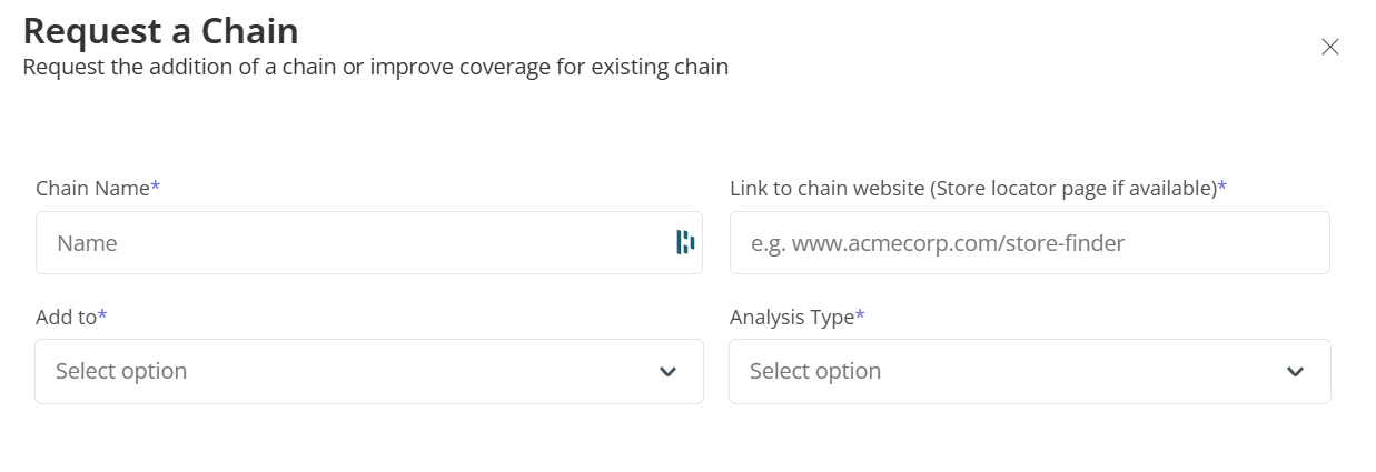
Chain – Request a new brand if it has 10+ locations.

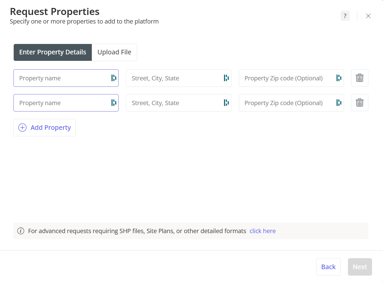
c. Follow the prompts for each request type. Under Property, you can enter location details manually or upload a CSV file (a template is provided).
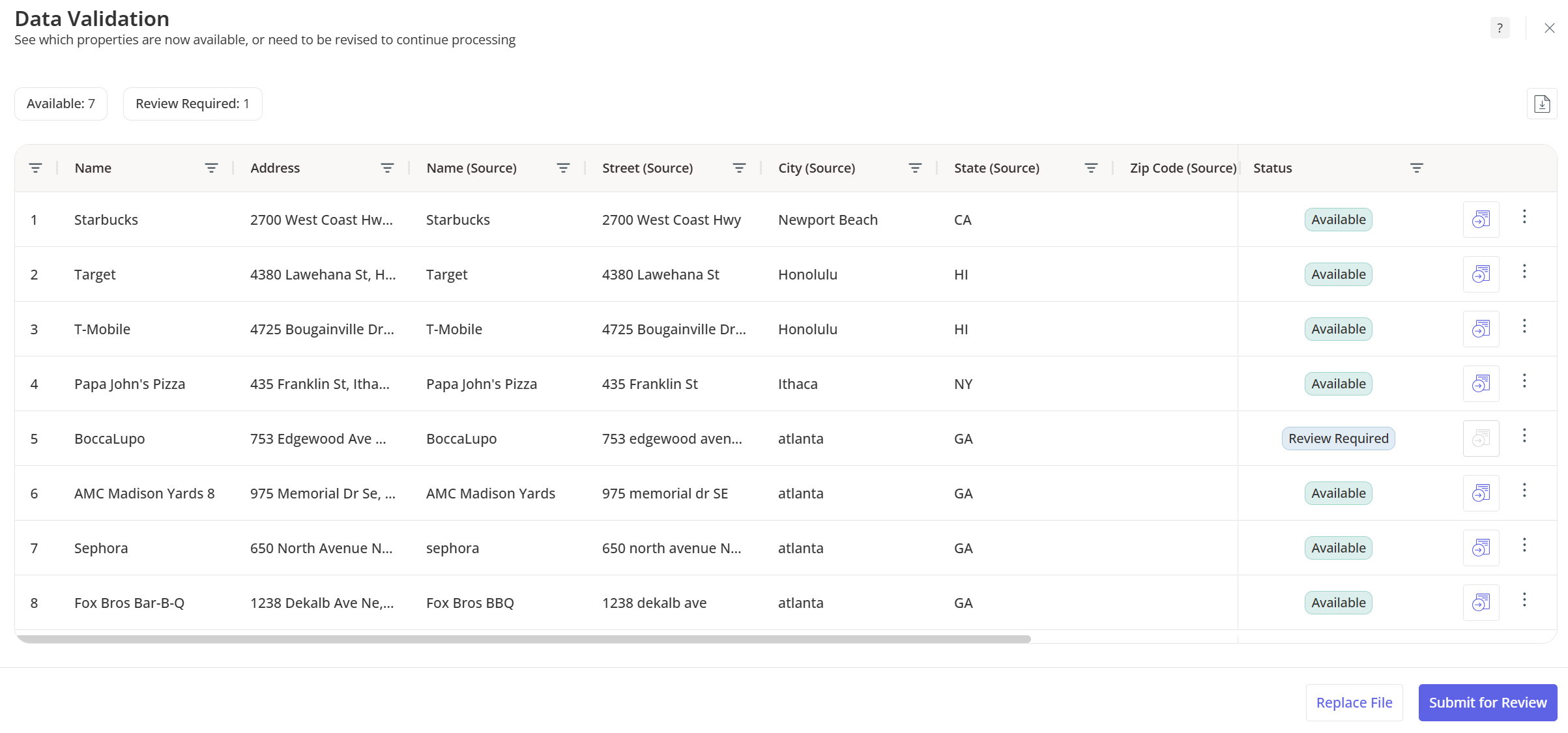
d. Once submitted, Placer’s system will run a coverage check (do not leave the screen, the processing can take up to 90 seconds) to check if the location already exists and notify you if it’s available. If a location is not available or needs further review, you can simply click "Submit for Review", and it will open a ticket.
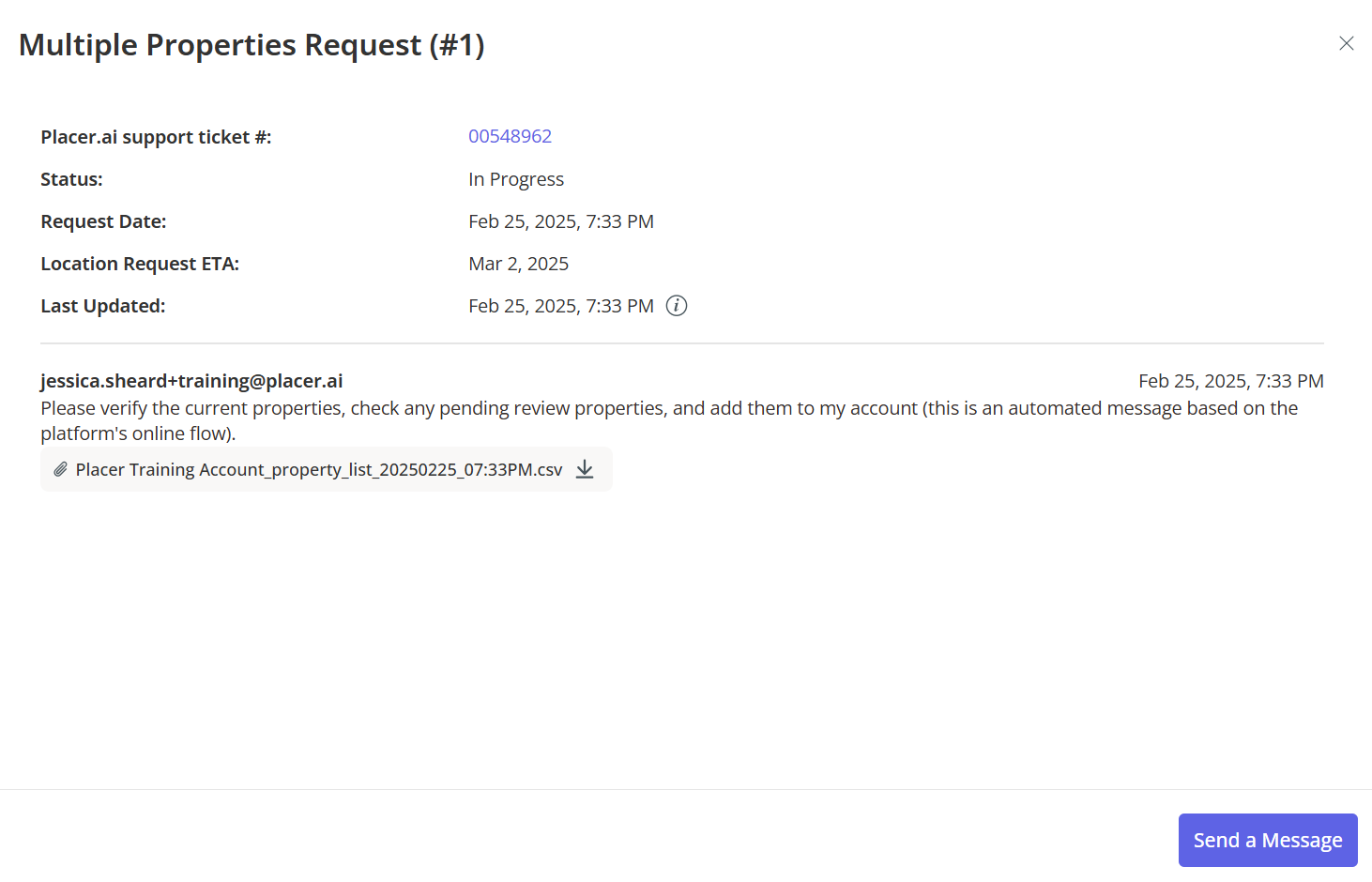
e. Tracking Your Requests: please note that it can take between 3-7 days for a location to be verified & added.
Once submitted, your request appears in My Requests, where you can track progress and view estimated completion times. You can also send messages within the request if additional details are needed. If the Placer Support teams needs additional information to complete the request, they will message you within the ticket (notifications also go to your email address).
f. If you are requesting a new Traffic Pin, the Support team needs an exact latitude/longitude for the placement of the traffic pin. This must be an official DOT road (no access roads, driveways, or parking lots.) Instructions are provided on how to find exact lats/longs within the request form for traffic pins.

g. If you are requesting a regional location, it helps to submit a zipped Shapefile or KMZ so the Support team uses the correct geographical boundaries. Instructions can be found in the Region request form.
h. If you are requesting a specific chain be added to Placer's platform, follow the instructions on the Chains request form. (Chains need to have at least 10 locations in the United States.) Additional details are available in the video above.
Additional tools available:
1. Custom POIs/Locations
- Used when a custom boundary is needed (e.g., a park section or event area).
- May not be usable in all Placer reports/sections.
2. Drop a Nearby Activity Pin
- Allows you to quickly analyze foot traffic trends in an area.
- Does not save for future sessions—useful for one-time analysis.